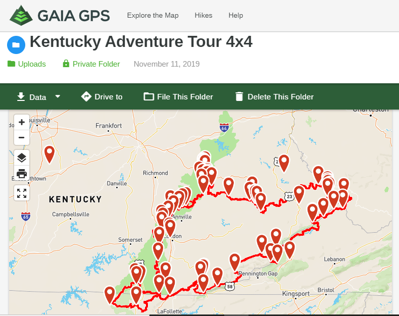
The Kentucky Adventure Tour is a 1000+mile overland route outlining most of southeast KY that also loops in and out of Tennessee, Virginia, and West Virginia. You can find more information on their and regular updates by joining their group on Facebook by searching "Kentucky Adventure Tour (KAT)". UPDATE June 2022: The KAT Facebook page is now the only location to find official, updated GPS map data**
The KAT is an overlanding route and is intended for road legal vehicles and has some highway connectors mixed in. There are two different versions, one for motorcycles and one for 4x4s, so be sure you download the correct file. The route utilizes some trails and roads inside OHV areas and offroad parks but is otherwise off limits to offroad only vehicles.

Kentucky Adventure Tour Facebook homepage
For starters, always go to the files in the Facebook group and check that you have the latest version of the map before each trip, as it regularly changes and gets updated. The map is available in .gpx format and can be uploaded to your GPS app of choice. There is a tutorial on the Facebook page under "Files" explaining how to upload the map to the MotionX GPS app. A lot of the members also use Gaia GPS, that's what I use, and the info on how to upload to it can be found in comments and discussion in the group as well, though there's not a direct tutorial.
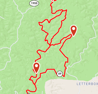
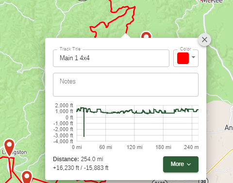
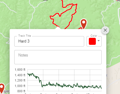
Once you upload the map to your GPS viewer you'll see that there are a few places where the map splits. These splits are for "hard" trails and you really need to pay attention to the posts and comments on these trails before attempting them. Apparently some of these hard trails are for hardcore rigs or singletrack that would be extremely difficult on a large ADV bike, but the main route can be done with less equipped rigs. The creator of the route has a really good description and recommendations on the Facebook group.
The Facebook group is a treasure trove of knowledge. If you’ve got a question about any part of the trail, chances are it’s already answered in the group.
The main loop was designed to be completed in rigs with only modest modifications, though conditions change. Anything off of a gravel road is subject to becoming impassable even in modest rain. Steep slopes and wet clay are a bad combo no matter where you’re at. Creek crossings are also scattered throughout and can become quite treacherous even in the smallest of storms.
If using Gaia GPS, switch on the Public Lands Overlay to help plan out a place to camp. A lot of the western part of the KAT is within the Daniel Boone National Forest with the Red River Gorge and the Daniel Boone Backcountry Byway offroad route making up the northernmost sections. The southernmost section loops around the Big South Fork National River and Recreation Area. The KAT runs through Cumberland Gap National Park in the southeast. The Washington and Jefferson National Forest and Breaks Interstate Park run along the Virginia border.
There are several offroad parks located along the KAT for those who want to add a bit extra seat time. Listed below in no particular order:
Mine Made Adventure Park - Located just north of Hindman at about 12:00 on the map.
RV hookups, cabins, primitive camping spots, and a lot of opportunity for dispersed camping. Trails are OHV oriented and better suited for the motorcycle riders on the KAT, though the main section of the park is worth the excursion for overlanders (and is free to sightsee). These are my hometown trails so there’s a decent info page here.
Southfork Elk View - Located between Hindman and Jackson, just west of Mine Made.
Trailhead with developed camp spots currently in development. Lots of opportunity for dispersed camping. Currently no charge for this park.
Black Mountain Off-Road Adventure Area - Located at roughly 4:00 on the map, just northwest of Harlan.
Black Mountain Off-Road requires a yearly pass. A lot of hardcore 4x4 trails within the park. The two trailheads are located in Putney and Evarts, developed campgrounds are located at both. Dispersed campgrounds are located within the park. You can access some of the dispersed campgrounds in a stock rig.
Hatfield McCoy Trails (Devil Anse Trailhead) - Located at roughly 1:00 (further northeast).
The Matewan, WV section is usually the section that gets the most praise by folks unfamiliar with the area. The Devil Anse Trailhead requires a yearly pass but has a lot of singletrack for those of you on two wheels.
Spearhead Trail’s Jawbone Trail - Located at roughly 2:00, between Elkhorn City KY and Grundy VA
Jawbone connects to Breaks Interstate Park and is the only 4x4 trail currently open within the Spearhead system. Breaks Park has a $2 per car day use fee at the park entrance and is a great sightseeing destination. The Lodge and Cabins are available year-round.
Wildcat Adventures Offroad Park - Located at roughly 9:00, near London.